


All text, graphics and images are original - Copyright © 2003-2009 by Nunya
Please refrain from using any content without the written consent of the author at
NatureWildChild@gmail.com
HIKING - BACKPACKING - CAMPING - SNORKELING - SCUBA - KAYAK -TRAVEL

FIND IT FAST!
Hit Control F
Type your Keyword
Jump to the hike you're looking for Fast!
IF YOU EXPERIENCE VIEWING PROBLEMS - disable your pop-up blocker
CLEAR YOUR INTERNET COOKIES/TEMP FILES - THEN REFRESH YOUR BROWSER
*initial blurry photos should resize to your system within a few seconds*

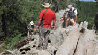
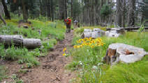
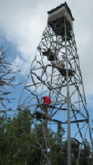
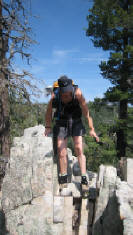

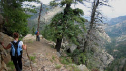
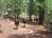
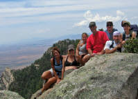
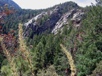
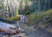
Webb Peak - at 10,029ft high in the Pinalenos Mt Graham Region of Arizona, is known to be the tallest of the "Southwestern Sky Islands". It is also the Southernmost old growth forest of spruce and fir on the U.S. Continent! The area is known to encompass five ecological systems, containing the highest diversity of habitats in the shortest vertical distance of any mountain range in North America. Go Virtual Hike with us a mere 3+ miles through this gorgeous old growth forest *MY kinda hike!!*, with an easy 900ft elevation change - and a bonus climb up another 50ft to the Fire Tower! (photos by Nunya)
08/19/2007 Webb Peak Loop - Mount Graham -
Coronado National Forest - Pinaleno Mountains -
Safford Arizona


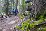
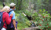

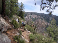
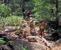
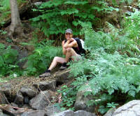
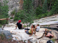
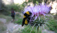
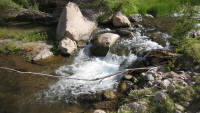
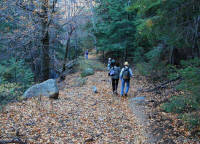
08/18/2007 Ash Creek - Mount Graham - Coronado National Forest - Pinaleno Mountains - Safford Arizona
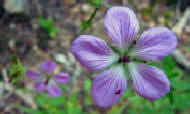
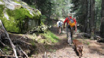
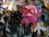
Craving a lush green hike with a babbling stream? Looking for cooler temps through wooded pines and panoramic views of mountain range? Go Virtual Hike with us to Ash Creek trail on Mt Graham AZ (6+ miles, 2500ft elevation change), for a taste to satisfy all your senses. (photos by Nunya)


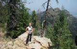
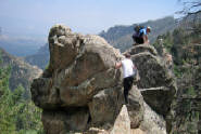
07/02/2006 Grant Trail - Goudy Trail - Mount Graham -
Pinaleno Mountains Arizona
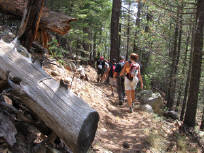
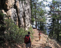

07/01/2006 Ash Creek - Mount Graham - Pinaleno Mountains Arizona

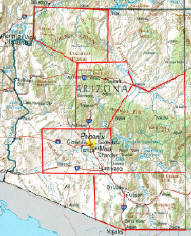
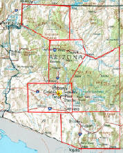
MT Graham - Pinal Arizona
and Surrounding area
GO VIRTUAL HIKE THROUGH A SAMPLING OF WHAT SCENERY,
TERRAIN, VEGETATION, AND ADVENTURES ARE AVAILABLE
FOR HIKING, CAMPING, AND BACKPACKING IN THIS AREA.
TRAIL AREAS DOCUMENTED ON THIS PAGE
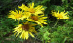
The official name for this area is the Pinaleno Mountains, Pinaleno being an Indian word meaning "many deer" or "mountain deer". Mount Graham is the peak, named in 1846 after James Duncan Graham, who was the Senior Officer in the Army Corps of Topographical Engineers. Reaching 10,720ft in elevation - Mount Graham is the tallest of the "SouthWestern Sky Islands". Located close to the Arizona-New Mexico border, by a little town called Safford - it is part of the Coronado National Forest in SouthEastern Arizona. A favorite refuge for hiking and camping, the area encompasses five ecological systems, and has been found to have living trees that date back to 1257 and 1270 A.D. The Pinaleno Mountains are home to the Southernmost old growth forest of Spruce and Fir on the Continent, with remains of fir trees found dating back to 1102 A.D.
ARAVAIPA CANYON - APRIL
PINAL MOUNTAINS
SIXSHOOTER CANYON - NOVEMBER
RESEARCH HIKES
VIRTUAL TRAVEL
VACATION GETAWAYS


FOR A LARGER VIEW
CLICK ON THE
BIGGER PHOTO
THEN SELECT
THE "FULL SCREEN"
OPTION TO YOUR
UPPER LEFT - F11
AND YOU CAN
CONTROL THE SPEED

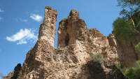
04/16/2009 Aravaipa Canyon Wilderness
Graham County and Pinal County Arizona
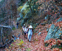
Aravaipa Canyon can be done as a dayhike - but backpacking it is definitely the best way to enjoy it and take the extra time to do the many side canyons with Ancient Ruins dating back to 1300 A.D.! Go Virtual Hike with us 5+ miles from Horse Camp Creek - and back to civilization, with a few more spectacular shots ending one really cool hike! (photos by Nunya)


FOR A LARGER VIEW
CLICK ON THE
BIGGER PHOTO
THEN SELECT
THE "FULL SCREEN"
OPTION TO YOUR
UPPER LEFT - F11
AND YOU CAN
CONTROL THE SPEED
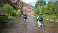
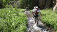
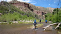
04/15/2009 Aravaipa Canyon Wilderness
Horse Camp Canyon to Turkey Creek
Graham County and Pinal County Arizona
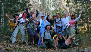
There are many words to describe Aravaipa Canyon's beauty - but it's visual beauty speaks to you. Go Virtual Hike with us 12+ miles from our campsite at Horse Camp Canyon, through Aravaipa Canyon to Turkey Creek - and back. Towering canyon walls, crystal clear creeks, a Gila Monster and group photo... In one word - Spectacular! (photos by Nunya)
FOR A LARGER VIEW
CLICK ON THE
BIGGER PHOTO
THEN SELECT
THE "FULL SCREEN"
OPTION TO YOUR
UPPER LEFT - F11
AND YOU CAN
CONTROL THE SPEED
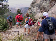
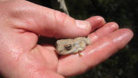
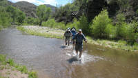
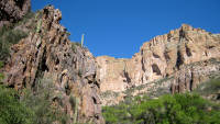
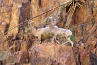
04/14/2009 Aravaipa Canyon Wilderness
Graham County and Pinal County Arizona
What is Aravaipa? Where is Aravaipa? Why would I want to see it? Go Virtual Hike with us as we backpack into Aravaipa Canyon - Located 120 miles SouthEast of Phoenix Arizona, Aravaipa is an Amazing WATER HIKE with Incredible rock cliffs! Big Horn Sheep! - and so much more! Get ready to Play!
Get ready to get WET! (photos by Nunya)


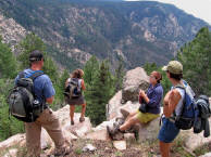
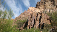
11/18/2006 Sixshooters Canyon - Tonto National Forest -
Pinal Mountains Arizona
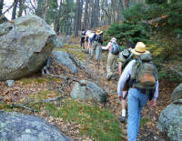
Undeniable - we are Serious hikers... Serious about having FUN that is! Some hikes have great views, but with this hike you are IN the great views! Go Virtual Hike with us in wonderful crisp temps between 40-50 degrees through the crunchy autumn leaves of red and gold, up 2600ft in 4.5 miles (and then down again 9+ miles round trip) on the Six-shooters Canyon trail located in the Pinal Mts just South of Globe. Six-shooters is aptly named from the miners on that section all carried six-shooters. (Photos by Nunya)
Virtual Hiking
ARIZONA
CALIFORNIA
COLORADO
HAWAII
KAUA'I
NEW MEXICO
OREGON
ST MAARTEN
UTAH
Over 300
Virtual Hikes
for
GoVirtualHike.com
RESEARCH HIKES
VIRTUAL TRAVEL
VACATION GETAWAYS
GoVirtualHike.com
Virtual Hiking
HIKING
CAMPING
BACKPACKING
GoVirtualHike.com
ARIZONA
CALIFORNIA
COLORADO
HAWAII
KAUA'I
NEW MEXICO
OREGON
ST MAARTEN
UTAH
Over 300
Virtual Hikes
for
Virtual Hiking
GoVirtualHike.com
RESEARCH HIKES
VIRTUAL TRAVEL
VACATION GETAWAYS
GoVirtualHike.com
HIKING
CAMPING
BACKPACKING
GoVirtualHike.com
Virtual Hiking
ARIZONA
CALIFORNIA
COLORADO
HAWAII
KAUA'I
NEW MEXICO
OREGON
ST MAARTEN
UTAH
Over 300
Virtual Hikes
for
RESEARCH HIKES
VIRTUAL TRAVEL
VACATION GETAWAYS
GoVirtualHike.com
HIKING
CAMPING
BACKPACKING
Virtual Hiking
GoVirtualHike.com
GoVirtualHike.com
GoVirtualHike.com

MT GRAHAM
ASH CREEK TRAIL - JULY
ASH CREEK TRAIL - AUGUST
GRANT TRAIL - JULY
GOUDY TRAIL - JULY
WEBB PEAK LOOP - AUGUST
GoVirtualHike.com
I AM AWARE THAT KODAK HAS MADE CHANGES TO THEIR SOFTWARE - THAT NOW SCREW UP YOUR VIEWING THOSE SLIDESHOWS - I'LL FIX THOSE AS SOON AS I CAN *SORRY*
I AM AWARE THAT KODAK HAS MADE CHANGES TO THEIR SOFTWARE - THAT NOW SCREW UP YOUR VIEWING THOSE SLIDESHOWS - I'LL FIX THOSE AS SOON AS I CAN *SORRY*
I AM AWARE THAT KODAK HAS MADE CHANGES TO THEIR SOFTWARE - THAT NOW SCREW UP YOUR VIEWING THOSE SLIDESHOWS - I'LL FIX THOSE AS SOON AS I CAN *SORRY*