


view their hiking calendar
of Phoenix Arizona - view their hiking calendar


03/25/2006 Black Mesa Loop -
tonto National Forest - Superstition Mountains Arizona
Go Virtual Hike with us as we do the 9 mile Black Mesa Loop counter-clockwise from the Dutchman trail, to Black Mesa trail, to Second Water trail - and back to First Water trailhead - with some Sonoran Desert rock climbing thrown in for a kick!
(photos by Nunya)
02/18/2007 Marsh Valley to Canyon Lake via Dutchman Trail -
to Bull Pass Trail - to Boulder Canyon Trail - Tonto National Forest -
Superstition Mountain Wilderness Arizona
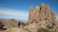
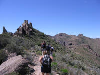
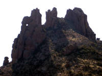
12/29/2007 Weaver's Needle Loop (clockwise) via Peralta Canyon Trail - to Dutchman Trail - to Bull Pass Trail - to Black Top Mesa - to Dutchman Trail - to Terrapin Trail - to Bluff Springs Trail -
Tonto National Forest - Superstition Mountains Arizona
01/13/2008 Bluff Springs - Miners Needle Loop -
Tonto National Forest - Superstition Mountain Wildernss Arizona
03/02/2008 Bluff Spring - Miners Needle Loop -
Tonto National Forest -
Superstition Mountain Wilderness Arizona
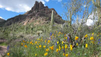
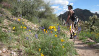
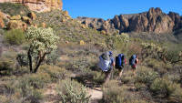
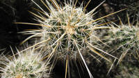
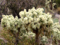
Springtime in Arizona turns the desert into an array of absolute Eye Candy!! Go Virtual Hike with us 9+ miles around the Bluff Springs - Miners Needle Loop (est 1400ft elevation change) where a dusting of flowers turns into a Grande Finale of blooming beauty! (photos by Nunya)
01/03/2009 Black Mesa Loop -
Tonto National Forest
Superstition Mountains Arizona
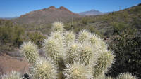
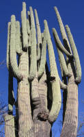
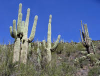
The Black Mesa Loop is an easy elevation, 9 mile loop connecting clockwise - Second Water trail, Black Mesa trail and Dutchman trail. Go Virtual Hike with us surrounded by the lichen covered Superstition Mountains of Arizona, through Saguaro cactus, Indian Ruins, and along trails embraced in Mesquite and Palo Verde trees. (photos by Nunya)

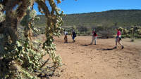
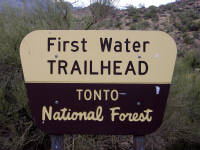
03/04/2007 First Water Trailhead - to Dutchman Trail #104, to Second Water Trail #236 - to Boulder Canyon Junction #103 - and then we go Primitive! - Tonto National Forest
Superstition Mountains Arizona
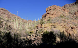
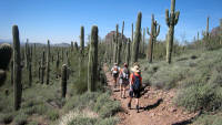
Go Virtual Hike with us on this Cactus Extravaganza hike! - from First Water Trailhead, as we take Dutchman Trail #104 and Second Water trail #236 to the Boulder Canyon junction #103 (3.6 miles, 480ft elevation change) - and then take a hop-skip and rock scramble down an umarked primitive trail for some really new and beautifully interesting terrain! (photos by Nunya)
02/24/2007 Garden Valley Loop -
Tonto National Forest
Superstition Mountains Arizona
This Garden Valley Loop takes you from Second Water Trail, and across Garden Valley to Hackberry Springs and back to First Water Trailhead via Dutchman Trail. Go Virtual Hike with us 5.4 miles through the Sonoran Desert and Lichen colored rocks of the Superstition Wilderness of Arizona.
(photos by Nunya)
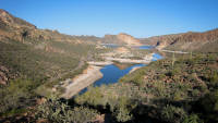
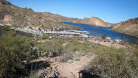
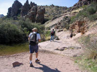
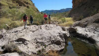
01/21/2008 Boulder Canyon Trail - Lower La Barge -
Tonto National Forest
Superstition Mountain Wilderness Arizona
Go Virtual Hike with us for some highlights around the Canyon Lake, Boulder Canyon trail, and Lower La Barge area, which takes you into the Superstition Wilderness of Arizona, and the Tonto National Forest. Reflect on the beauty of the day, as we remember the life and trails shared with hiking friend
Lyman Scott. (photos by Nunya)
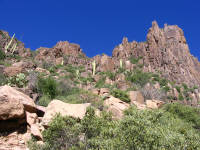
03/26/2005 Carney Springs across the Superstition Ridgeline -
down Siphon Draw - Superstition Mountains -
Tonto National Forest Arizona
02/17/2007 Boulder Canyon to Marsh Valley via Canyon Lake -
to Boulder Canyon Trail - to Dutchman Trail -
Tonto National Forest - Superstition Mountain Wilderness Arizona

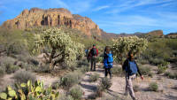
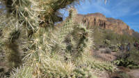
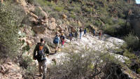
GO VIRTUAL HIKE THROUGH A SAMPLING OF WHAT SCENERY,
TERRAIN, VEGETATION, AND ADVENTURES ARE AVAILABLE
FOR HIKING, CAMPING, AND BACKPACKING IN THIS AREA.
FIND IT FAST!
Hit Control F
Type your Keyword
Jump to the hike you're looking for Fast!
west superstition mountains
and Surrounding area
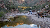
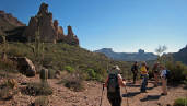
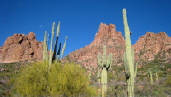
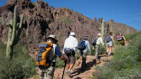
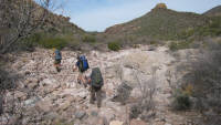
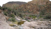
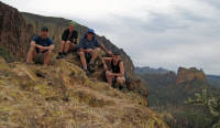
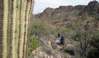
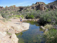
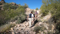
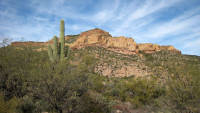
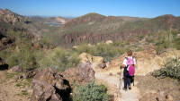
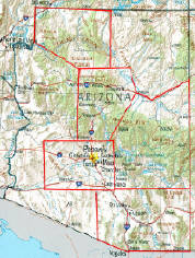
Located East of Phoenix Arizona in the Tonto National Forest...
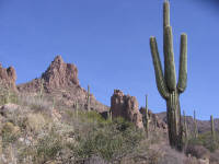
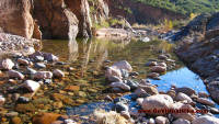
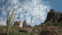
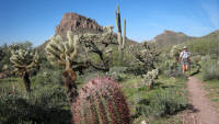
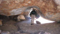
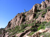
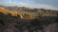
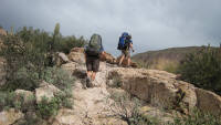
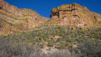
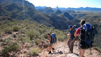
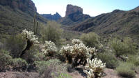
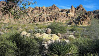
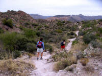
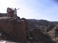
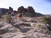
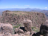
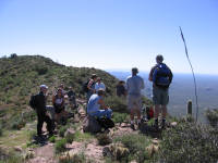
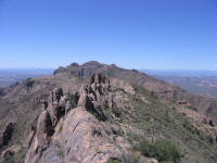
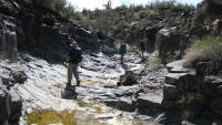
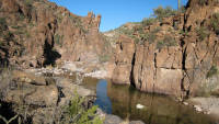
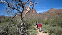
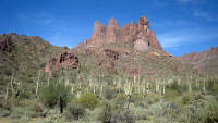
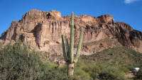
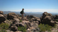
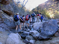
The Superstition Wilderness covers over 160,000 acres, and offers more than 180 miles of trails to hike within the Mountains and Wilderness area -with elevations ranging between 2,000 - 6,265 feet.
TRAIL AREAS DOCUMENTED ON THIS PAGE
LOWER LABARGE - JANUARY, MARCH
MARSH VALLEY - FEBRUARY
MINERS NEEDLE LOOP - JANUARY, FEBRUARY, MARCH
PERALTA TRAIL - FEBRUARY, DECEMBER
RIDGELINE - JANUARY, FEBRUARY, MARCH
ROBBER'S ROOST - MARCH
SECOND WATER TRAIL - JANUARY, MARCH
SIPHON DRAW - JANUARY, FEBRUARY, MARCH
TERRAPIN TRAIL - FEBRUARY, DECEMBER
WEAVER'S NEEDLE LOOP - FEBRUARY, DECEMBER

BLACK TOP MESA - DECEMBER
BLUFF SPRINGS - JANUARY, FEBRUARY, MARCH
BOULDER CANYON - JANUARY, FEBRUARY
BULL PASS TRAIL - FEBRUARY, DECEMBER
CANYON LAKE - JANUARY, FEBRUARY
CARNEY SPRINGS - JANUARY, FEBRUARY, MARCH
CALVARY TRAIL - FEBRUARY
COFFEE FLAT TRAIL - FEBRUARY
DACITE MESA - MARCH
DUTCHMAN TRAIL - JANUARY, FEBRUARY, MARCH, DECEMBER
FIRST WATER - JANUARY, FEBRUARY, MARCH
GARDEN VALLEY LOOP - FEBRUARY

Over 300
Virtual Hikes
for
HIKING
CAMPING
BACKPACKING


03/01/2009 Lost Goldmine Trail - Tonto National Forest
Superstition Mountains Arizona
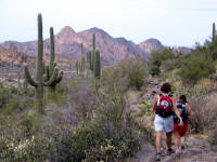
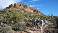
Once an area home to Apache, Salado and Ho Ho Kam Indians - the Goldmine Trail hugs the base of the Superstition Mountains of Arizona, Around 40 miles East of Phoenix Arizona - and is friendly to hikers, mountain bikes, horses and dogs. Go Virtual Hike with us as we pass through the area where the Legend of Jacob Waltz and the Lost Dutchman's mine began - with his death in 1891.
(photos by Nunya)

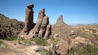
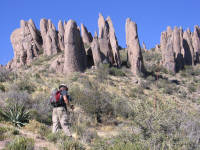
03/22/2009 Dacite Mesa Super Loop to Robber's Roost
Tonto National Forest - Superstition Mountains Arizona
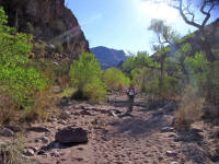
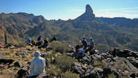
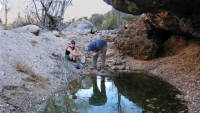
Located in the spiraling hoodoos on Dacite Mesa - high up above Peralta Trail in the Superstition Mountains of Arizona, Robber's Roost is effectively hidden without a knowlegable guide to lead you there. Go Virtual Hike with us to this mystery spot - from Lost Goldmine Trail, up Carney Springs to West Boulder Saddle, across Dacite Mesa to Fremont Saddle, and down Peralta Trail. A good 6+ mile dayhike (est 2395ft accumulative elevation change), and an excellent backpacking trip when the water is flowing. (photos by Nunya)
IF YOU EXPERIENCE VIEWING PROBLEMS - disable your pop-up blocker -
CLEAR YOUR INTERNET COOKIES/TEMP FILES - THEN REFRESH YOUR BROWSER
*initial blurry photos should resize to your system within a few seconds*
FOR A LARGER PICTURE VIEW - START THE SLIDESHOW AND CLICK A SLIDESHOW PHOTO - THEN SELECT THE
"FULL SCREEN" OPTION TO YOUR UPPER LEFT OF THAT SCREEN - HIT F11 AND YOU CAN CONTROL THE SPEED
of Phoenix Arizona - view their hiking calendar
view their hiking calendar
view their hiking calendar
of Phoenix Arizona - view their hiking calendar
Sierra Singles, and Take-A-Hike of Phoenix Arizona -
view their hiking calendars
view their hiking calendar
view their hiking calendar
view their hiking calendar
view their hiking calendar
of Phoenix Arizona - view their hiking calendar
view their hiking calendar
view their hiking calendar
view their hiking calendar
view their hiking calendar
view their hiking calendar
view their hiking calendar

HIKING - BACKPACKING - CAMPING - SNORKELING - SCUBA - KAYAK -TRAVEL
All text, graphics and images are original - Copyright © 2003-2010 by Nunya
Please refrain from using any content without the written consent of the author at
NatureWildChild@gmail.com
01/29/2006 Bluff Springs - Miners Needle Loop
Tonto National Forest
Superstition Mountains Arizona
The Bluff Springs Loop in the Superstition Wilderness Mountains of Arizona - is a relatively easy hike, yet rocky and steep in spots - 9 mile loop (1400ft ec) that starts at the Peralta Trailhead. Go Virtual Hike along with us as we take the Dutchman 104 trail to the Bluff Springs 235 trail, with beautiful panoramic views including Weaver's Needle, Miner's Needle, Bluff Spring Mt & Picacho Butte. (photos by Nunya)
02/04/2006
Carney Springs Across The Superstition Ridgeline - Down Siphon Draw - Tonto National Forest
Superstition Mountains Arizona
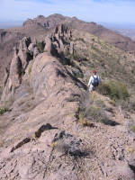
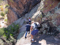
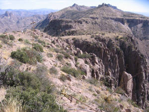
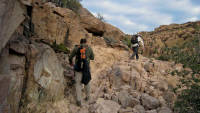
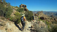
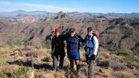
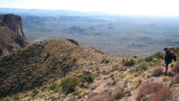
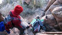
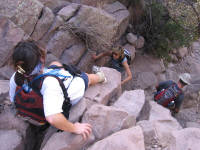
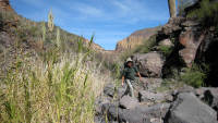
The Ridgeline hike across the Superstition Mountains in Arizona - is a grueling 12+ mile trek of physical endurance, intense boulder and rock climbing, beginning with a 2567ft elevation gain in the first 3.5 miles up Carney Springs, for an accumulated elevation gain of just under 5000ft. Go Virtual Hike with us as we scale across the Superstitions Ridgeline and boulder climb down Siphon Draw - a 2493ft drop in the first mile! (photos by Nunya)
02/05/2006
Black Mesa Loop - Tonto National Forest
Superstition Mountains Arizona
Black Mesa loop via First Water in the Superstition Mountains of Arizona - is an easy 8+ mile follow-up to the killer 12 mile boulder hopping/rock climbing Ridgeline hike from the day before. (photos by Nunya)
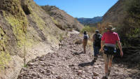
02/19/2006 Coffee Flat Trail Via Dutchman Trail -
To Coffee Flat - To JF Trail - To Cross Cut Trail -
Tonto National Forest
Superstition Mountains Arizona
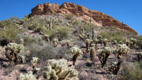
Kick back and Go Virtual Hike with us 22.75 miles (round trip) in the Superstition Mountains of Arizona, with a 3302ft accumulative elevation change (per our GPS boys)... as we transport you through a natural botanical Saguaro Paradise - starting at the Peralta Trailhead on Lost Dutchman, to Coffee Flat, to JF Trail, to Crosscut Trail, back to Coffee Flat and out Dutchman Trail. (Photos by Nunya)
01/14/2007 Carney Springs - across the Superstition Ridgeline - down Siphon Draw - Tonto National Forest
Superstition Mountains Arizona
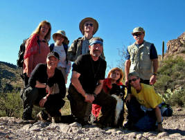
The trail up and across the Ridgeline of the Superstitions in Arizona leaves you wishing for one thing - a real trail! This primitive and unmaintained to non-existent 12 mile trail up Carney Springs, across the Ridgeline, and down Siphon Draw is a brutal test of endurance where serious injury is a constant reality with every step. Go Virtual Hike with us through this jam-packed album of rock scrambling madness that we unanimously voted that we HATE... which will leave us with one question at the end - "When can we do it again!" (Photos by Nunya)
02/04/2007 Weaver's Needle Loop Via Dutchman Trail -
To Bluff Springs Trail - To Terrapin Trail - To Dutchman Trail -
To Peralta Trail - Tonto National Forest
Superstition Mountains Arizona
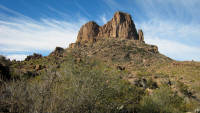
Weaver's Needle stands majestically elegant as a giant center piece on a well laid out buffet of amazing rock formations and colors. This is definitely one hike not to miss, because the further you go in - the better it gets! Go Virtual Hike with us 14 miles around the Weaver's Needle Loop, on a hike that is alternately easy and also challenging *take extra water!* (Photos by Nunya)
AzUSA - Builders.com

Commercial - Residential
General Contractor
OVER 300
HIKES FOR
ARIZONA
CALIFORNIA
COLORADO
HAWAII
KAUA'I
NEW MEXICO
OREGON
ST MAARTEN
UTAH
RESEARCH HIKES
VIRTUAL TRAVEL
VACATION GETAWAYS
OVER 300
HIKES FOR
ARIZONA
CALIFORNIA
COLORADO
HAWAII
KAUA'I
NEW MEXICO
OREGON
ST MAARTEN
UTAH
GoVirtualHike.com
OVER 300
HIKES FOR
ARIZONA
CALIFORNIA
COLORADO
HAWAII
KAUA'I
NEW MEXICO
OREGON
ST MAARTEN
UTAH
HIKING
CAMPING
BACKPACKING
RESEARCH HIKES
VIRTUAL TRAVEL
VACATION GETAWAYS
OVER 300
HIKES FOR
ARIZONA
CALIFORNIA
COLORADO
HAWAII
KAUA'I
NEW MEXICO
OREGON
ST MAARTEN
UTAH
GoVirtualHike.com
OVER 300
HIKES FOR
ARIZONA
CALIFORNIA
COLORADO
HAWAII
KAUA'I
NEW MEXICO
OREGON
ST MAARTEN
UTAH
HIKING
CAMPING
BACKPACKING
RESEARCH HIKES
VIRTUAL TRAVEL
VACATION GETAWAYS
OVER 300
HIKES FOR
ARIZONA
CALIFORNIA
COLORADO
HAWAII
KAUA'I
NEW MEXICO
OREGON
ST MAARTEN
UTAH
OVER 300
HIKES FOR
ARIZONA
CALIFORNIA
COLORADO
HAWAII
KAUA'I
NEW MEXICO
OREGON
ST MAARTEN
UTAH
RESEARCH HIKES
VIRTUAL TRAVEL
VACATION GETAWAYS
OVER 300
HIKES FOR
ARIZONA
CALIFORNIA
COLORADO
HAWAII
KAUA'I
NEW MEXICO
OREGON
ST MAARTEN
UTAH
GoVirtualHike.com
OVER 300
HIKES FOR
ARIZONA
CALIFORNIA
COLORADO
HAWAII
KAUA'I
NEW MEXICO
OREGON
ST MAARTEN
UTAH
HIKING
CAMPING
BACKPACKING
RESEARCH HIKES
VIRTUAL TRAVEL
VACATION GETAWAYS
OVER 300
HIKES FOR
ARIZONA
CALIFORNIA
COLORADO
HAWAII
KAUA'I
NEW MEXICO
OREGON
ST MAARTEN
UTAH
GoVirtualHike.com
OVER 300
HIKES FOR
ARIZONA
CALIFORNIA
COLORADO
HAWAII
KAUA'I
NEW MEXICO
OREGON
ST MAARTEN
UTAH
HIKING
CAMPING
BACKPACKING
RESEARCH HIKES
VIRTUAL TRAVEL
VACATION GETAWAYS
OVER 300
HIKES FOR
ARIZONA
CALIFORNIA
COLORADO
HAWAII
KAUA'I
NEW MEXICO
OREGON
ST MAARTEN
UTAH